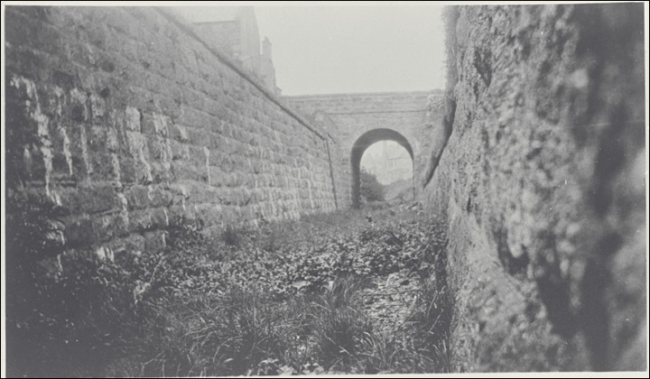
The incline ran through this cutting - - (as seen in the mid-1930s)
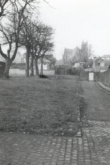
- - and alongside Drummond Street
The incline ran through this cutting - - (as seen in the mid-1930s) |
- - and alongside Drummond Street |
The photo on the left came from an account of the railway by Don Martin and Paul Bamford (link not working now). The same photo appears in Niall Ferguson's book The Dundee & Newtyle Railway (OAKWOOD PRESS, 1995) and he says that the bridge carries Somerville Place over the line (Somerville Place in the road on the north side of the Royal Infirmary), which means that this photo was taken at the top of the passing loop.
The line of the inclined track to the north of the hospital is now occupied by the grassy area between Drummond Street (which is to the left of the line of trees in the right hand photo) and a narrow lane on the east side of the track. I had always assumed that the track was at ground level at this point, but to fit with the other picture, this area must represent a cutting which has been back filled.
This also fits in with the description in the Building Brief for the Royal Infirmary (link not working) which said that "There is evidence of a tunnel viaduct entrance to the north east of the Caird block".
The stationary engine was located below the level of the High Kirk, seen at the back of the photo.
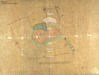 This 19th century map shows "Dundee Law, Lawton, Coldside, Lawside, old railway and engine house [Dundee and Newtyle Railway Company], Hospital Park, Albany Terrace and Water Commissioners Ground and Quarry".
Please feel free to contact me by e-mail at elliottsimpson@hotmail.com
May 2019